
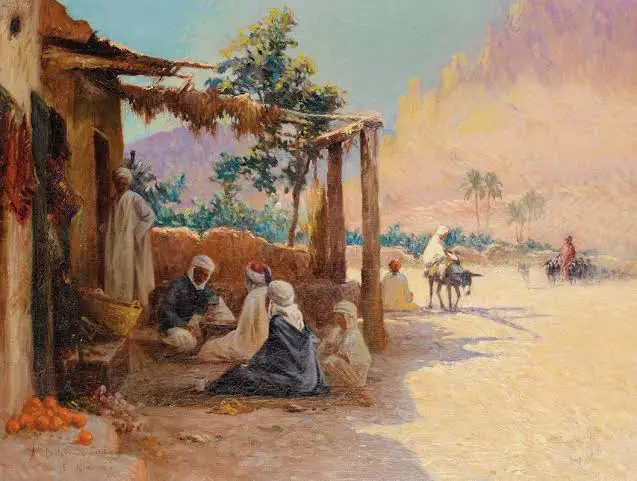
The name al-kântara is connected with an Arabic word commonly associated with a bridge, crossing, or elevated passage. Over time, similar forms of the name have appeared in different parts of North Africa, the Middle East, and Europe. That can make the term confusing for travelers and researchers who encounter it in historical records, maps, or travel guides.
Rather than identifying a single place, the name can point to several locations with different histories. Some are associated with ancient military routes, others with Roman engineering, and some with modern communities. The most useful way to understand the term is to look at its linguistic background and then examine the places where related names became established.
What Does Al-Kântara Mean?
The Arabic term al-qanṭara is generally translated as “the bridge” or “arched bridge.” The underlying idea refers to a structure that allows people, animals, or vehicles to cross an obstacle such as a river, valley, canal, or ravine.
The word has an interesting history because it moved beyond Arabic-speaking regions and became part of local place names. Different languages adapted its pronunciation and spelling, producing forms such as Qantara, Kantara, El Kantara, Alcántara, and similar variants.
This explains why two locations with nearly identical names can have completely different geographical settings.
A place carrying this name may have developed around:
- A natural crossing point
- An ancient road or trade route
- A river crossing
- A mountain gorge
- A strategically important passage
- A constructed bridge
- A settlement located near an old transportation route
The name therefore provides a useful clue about the historical importance of movement and crossing, but it does not by itself identify one particular destination.
The Egyptian Qantara and Its Strategic Setting
One of the best-known places associated with the name is El Qantara in northeastern Egypt. The settlement is located in the Ismailia Governorate and is divided by the Suez Canal.
Its position gives it significance far beyond its size. The Suez Canal separates the African and Asian sides of Egypt, while the area around Qantara has historically served as a passage between the Nile Valley and territories farther east.
The location became especially important because northeastern Egypt has long been a natural corridor between Africa and Asia. Armies, merchants, travelers, and goods could move through this region toward the Sinai Peninsula and beyond.
Today, the area remains connected with transportation between the two sides of the canal. The Mubarak Peace Bridge, also known as the Egyptian-Japanese Friendship Bridge, provides a major road connection across the Suez Canal.
This combination of geography, transportation, and history makes the Egyptian location particularly significant when studying the broader meaning of the name.
Ancient Roots of the Egyptian Crossing
The area around modern Qantara has a much older history than the present settlement suggests.
Northeastern Egypt was historically protected by a chain of routes, fortifications, and settlements designed to control movement toward the eastern frontier. Ancient Egyptian military expeditions heading into the Levant had to pass through this general region.
Historical sources associate the wider area with ancient names including Zaru and Sile. These sites formed part of Egypt’s eastern defensive system and helped regulate movement through the desert frontier.
The landscape itself explains why such places mattered. Travelers moving from the Nile Delta toward Sinai faced stretches of difficult terrain and limited water. A known route with access to resources could therefore become strategically valuable.
For ancient governments, controlling a crossing was not simply about transportation. It could also mean controlling:
- Military movements
- Trade routes
- Diplomatic travel
- Migration
- Communication between regions
The Egyptian Qantara consequently fits into a much older pattern in which crossings became centers of political and economic importance.
How the Suez Canal Changed the Area
The opening of the Suez Canal in the nineteenth century dramatically changed the geography of northeastern Egypt.
Before the canal became one of the world’s major maritime routes, movement between the Mediterranean and the Red Sea required longer journeys around Africa or through overland connections. The canal created a direct maritime passage through Egypt.
Qantara’s position near the canal gave the settlement a new role in transportation and communication.
The canal also transformed the surrounding landscape. New towns, roads, railways, and infrastructure developed as international shipping expanded. Locations that had once been important primarily because of land routes became connected to a global maritime network.
This is one reason the modern history of the Egyptian settlement cannot be separated from the history of the Suez Canal.
The canal turned the region into part of a much larger system linking Europe, the Mediterranean, the Middle East, Asia, and East Africa.
El Kantara in Algeria: A Different Landscape
Another important location with a related name is El Kantara in Algeria.
Unlike the Egyptian settlement, El Kantara is famous for its dramatic desert and mountain scenery. It is located in Biskra Province, where the landscape creates a natural transition between the mountainous north and the Sahara farther south.
The area is particularly known for a striking gorge through which routes have historically passed. The natural formation helped make the location an important gateway between different geographic zones.
This explains the continued relevance of the “bridge” idea even though there is no need for the name to refer exclusively to a conventional stone bridge.
A natural gorge can function as a bridge in a broader geographic sense: it provides a route through terrain that would otherwise be difficult to cross.
Travelers visiting El Kantara commonly encounter a combination of:
- Rocky mountain scenery
- Desert landscapes
- Palm groves
- Historic architecture
- Traditional settlements
- Ancient transportation routes
The contrast between the dry surrounding environment and cultivated areas gives the Algerian location much of its visual character.
Why El Kantara Became Known as a Gateway
Geography played a major role in the development of El Kantara.
Mountain barriers can make travel between northern and southern regions difficult. A naturally accessible passage through those barriers becomes valuable for trade, communication, and settlement.
For centuries, routes through the area helped connect communities on opposite sides of the mountainous landscape. Roman travelers also recognized the strategic value of the passage, and traces of Roman influence remain part of the area’s historical identity.
The settlement is sometimes described through imagery associated with the “Mouth of the Desert.” That description reflects its geographical position near the transition from mountain country to the Sahara.
The result is a location where history and geography are closely connected. Its importance did not come from political power alone; the physical landscape itself helped determine why people traveled through the area.
Alcántara in Spain and Its Famous Roman Bridge
A related but geographically distant name appears in Spain: Alcántara, a historic municipality in the province of Cáceres in Extremadura.
The Spanish name is particularly famous because of the monumental Roman bridge over the Tagus River.
The bridge is one of the most recognizable examples of Roman engineering in Spain. Built during the reign of Emperor Trajan in the early second century, it demonstrates how Roman infrastructure supported transportation across difficult terrain.
Its significance goes beyond architecture. A major bridge could influence the development of roads, trade, military logistics, and settlement patterns.
The surrounding municipality also has a strong medieval history. Alcántara became associated with the Order of Alcántara, a military religious order that played a role in the history of medieval Iberia.
This creates a fascinating connection between the name and the physical idea behind it. In Spain, the association is especially visible because a monumental bridge became the defining historical landmark of the town.
The Lebanon Connection
There is also a municipality called Al-Qantara in southern Lebanon’s Marjayoun District.
Its setting is quite different from the major Egyptian crossing, the Algerian gorge, or the Roman bridge in Spain. It is a rural Lebanese community whose name shares the same broader linguistic family.
This example demonstrates why geographical context matters when searching for a place using the name alone.
Someone looking for information about “Qantara” could potentially be referring to:
| Location | Country | Main association |
|---|---|---|
| El Qantara | Egypt | Suez Canal and historic eastern route |
| El Kantara | Algeria | Mountain gorge and Sahara gateway |
| Alcántara | Spain | Roman bridge and medieval history |
| Al-Qantara | Lebanon | Rural municipality in southern Lebanon |
Although the names look similar, each location has its own historical background and cultural setting.
The Linguistic Journey of the Name
The spread of related place names is also interesting from a linguistic perspective.
Arabic place names have historically crossed linguistic and cultural boundaries through trade, migration, political contact, and geographic exchange. When a word enters another language, its pronunciation can change while its basic meaning remains recognizable.
That helps explain the similarities among Qantara, Kantara, and Alcántara.
The Spanish form contains the Arabic article al- and the adapted form of qanṭara. The Spanish pronunciation and spelling evolved according to the phonetic conventions of the language.
Similar adaptations occurred in North Africa and the Middle East.
Place names can therefore preserve historical connections even when modern residents speak completely different languages. A name that originally described a bridge or crossing can survive for centuries after the original structure has changed or disappeared.
Why Crossings Matter in Human History
The story behind these places reflects a broader historical pattern.
Settlements frequently develop near crossings because movement is one of the foundations of economic and political life. Rivers, mountains, deserts, and canals can all create obstacles. A reliable route through such an obstacle becomes valuable.
Crossings can attract:
- Merchants looking for safer routes
- Governments protecting strategic territory
- Armies moving between regions
- Farmers transporting goods
- Travelers searching for water and shelter
- Communities establishing permanent settlements
A bridge does not merely connect two pieces of land. It can connect markets, cultures, political territories, and communities.
That broader idea helps explain why names derived from the concept of a bridge appear in multiple regions.
What Makes These Places Historically Important?
The locations associated with this name share several themes even though their individual histories differ.
Strategic geography
Each location has some relationship with movement through challenging terrain or across an important physical barrier.
Transportation
Roads, bridges, canals, and natural passages played important roles in their development.
Cultural exchange
Places positioned along major routes often became meeting points for people from different regions.
Military importance
Several of these locations were valuable because controlling a passage could provide a defensive or logistical advantage.
Architectural heritage
In Spain especially, the physical bridge itself became an enduring monument, while other locations preserve archaeological and historical remains connected with earlier transportation systems.
These similarities make the name more than a simple geographic label. It represents a recurring relationship between people and the landscapes they need to cross.
Planning a Visit to a Qantara-Related Destination
Travelers should first identify which country and location they mean. Searching only for the name can easily lead to information about the wrong destination.
For an informed trip, check:
- Country and region – Confirm the exact location before booking transportation.
- Nearest major city – Determine how far the site is from an airport or major transport hub.
- Historical attractions – Look for museums, archaeological sites, bridges, forts, and old quarters.
- Climate – Algeria and Egypt can experience intense heat, while Spain has its own seasonal conditions.
- Local access – Some historic locations are rural and may require road travel.
- Opening arrangements – Historic monuments can have changing visiting schedules.
- Local guidance – A knowledgeable local guide can provide context that online summaries often miss.
The best experience comes from treating these destinations as living communities and historical landscapes rather than simply checking off a landmark.
Common Misunderstandings About Al-Kântara
One frequent mistake is assuming that every use of the name identifies the Egyptian city.
That is not the case.
The name appears in multiple countries, and spelling differences can make searches even more confusing. A traveler searching for “Alcantara” may encounter Spanish results, while “El Kantara” may lead toward Algeria and “El Qantara” commonly points toward Egypt.
Another misunderstanding is that the name always refers to a man-made bridge. In some places, the historical significance comes from a natural passage or crossing rather than a surviving bridge.
The safest approach is to combine the name with the country, province, city, or landmark being researched.
Al-Kântara in Historical and Cultural Research
Researchers can use these locations to explore several broader subjects, including ancient transportation, Arabic linguistics, Roman engineering, North African geography, military history, and the development of trade networks.
The subject is especially useful for understanding how geography influences civilization.
A mountain pass can shape a settlement. A river crossing can attract a road. A canal can transform a town into an international transportation point. A Roman bridge can preserve evidence of an empire’s engineering and logistical ambitions for nearly two thousand years.
Seen from this perspective, the different places connected with al-kântara are not isolated curiosities. They illustrate how humans have repeatedly adapted infrastructure and settlement patterns around the challenge of moving from one place to another.
Frequently Asked Questions
What does al-kântara mean?
The name comes from the Arabic term al-qanṭara, generally associated with a bridge or arched crossing. Its meaning is connected with the idea of passing over an obstacle. Different languages and regions adapted the word, creating forms such as Qantara, Kantara, and Alcántara.
Where is El Qantara in Egypt?
El Qantara is located in northeastern Egypt in Ismailia Governorate, alongside the Suez Canal. Its location has historically made it an important route between the Nile Valley and the Sinai Peninsula. Today, the area remains connected with major road and transportation infrastructure crossing the canal.
Why is El Kantara in Algeria famous?
El Kantara in Algeria is known for its dramatic gorge and its position between mountainous northern Algeria and the Sahara. The natural passage historically helped travelers move through difficult terrain. The surrounding landscape combines rocky formations, palm groves, desert scenery, and historical remains.
What is Alcántara in Spain known for?
Alcántara in Spain is best known for its monumental Roman bridge over the Tagus River. The bridge dates from the early Roman imperial period and is an important example of ancient engineering. The town also has medieval associations with the Order of Alcántara.
Are Qantara and Alcántara the same place?
No. They are separate locations in different countries. Their names are linguistically related, but their histories and geographic settings differ. Qantara commonly refers to places in Arabic-speaking regions, while Alcántara is the Spanish form associated particularly with the municipality in Extremadura and its famous Roman bridge.
Why are there similar place names in different countries?
The similarity comes from the historical spread and adaptation of the Arabic word associated with a bridge or crossing. Languages often modify foreign words to fit their own pronunciation and spelling systems. Over centuries, those adapted forms can become established geographical names.
Is the Egyptian Qantara near the Suez Canal?
Yes. El Qantara is directly associated with the Suez Canal and is divided by the canal. Its location makes it part of the transportation network connecting the African and Asian sides of Egypt. The area has also been important historically because of its position near routes leading toward Sinai.
What should I search for if I want information about a specific Qantara?
Add the country or region to your search. For example, “El Qantara Egypt,” “El Kantara Algeria,” “Alcántara Spain,” or “Al-Qantara Lebanon” will produce much more precise results than searching for the name alone.
Final Thoughts
The history of al-kântara demonstrates how a simple idea such as a bridge can become embedded in the geography and identity of different communities. From the Suez Canal region of Egypt to the desert gateway of Algeria and the monumental Roman bridge in Spain, related names appear in places shaped by movement and connection.
Understanding the exact location is essential because each destination has its own story. Together, however, they reveal a common historical theme: people build communities, roads, and civilizations around the routes that allow them to cross natural barriers and connect with the wider world.